3D Laser Scanning
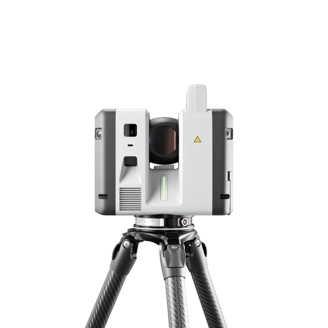
High-accuracy terrestrial LiDAR for buildings, interiors, façades, plants and infrastructure, registered into one clean point cloud.
OutE57 · RCP · LAS
Zombra scans buildings, sites and objects, then delivers the point clouds, as-built drawings and Revit models your team builds from, registered to 2–6 mm, so nobody measures twice.
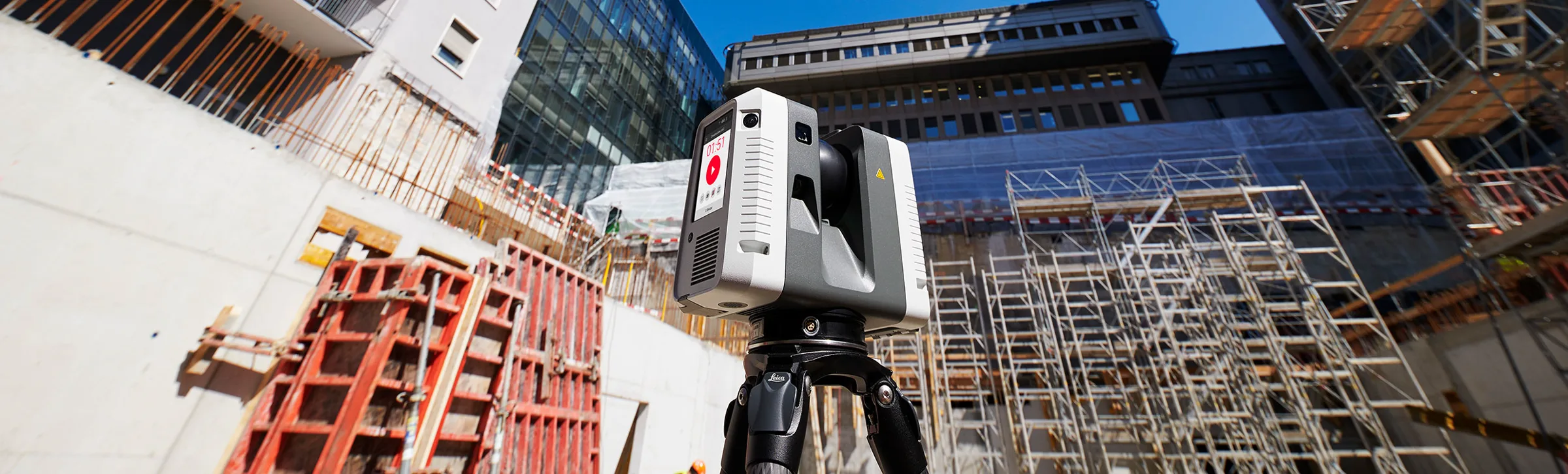
Old drawings are often wrong. Tape measurements drift. Fabricated parts arrive on site and don’t fit. Zombra replaces all of it with one registered record of existing conditions, captured by terrestrial laser scanning. Then it turns that record into the exact file the next trade needs.
ZMB / Output layers
Terrestrial scanning records the stair as it actually stands, down to every tread, stringer and out-of-plumb post, as a measurable point cloud.
Services
Reality captured. Made useful.
Six core services, one field team. Whether you need 3D laser scanning services, as-built drawings or a Revit model, we start from the deliverable you need and work backward to the right capture method.
High-accuracy terrestrial LiDAR for buildings, interiors, façades, plants and infrastructure, registered into one clean point cloud.
OutE57 · RCP · LAS
Measured floor plans, reflected ceiling plans, elevations and sections, drawn directly from field data instead of old sets.
OutDWG · DXF · PDF
Point clouds converted into coordinated Revit models at a stated LOD, for renovation, design development and construction.
OutRVT · IFC · NWD
Aerial capture of roofs, terrain, façades and large sites, with orthomosaics, meshes and contextual site data.
OutOrthomosaic · OBJ · LAS
Measurable, link-shared replicas of facilities that owners and teams can walk, measure and review from anywhere.
OutWeb viewer · E57
Parts, assemblies and sculptures rebuilt as clean, dimensioned CAD when no original drawings or models exist.
OutSTL · OBJ · DWG
Also delivered
Process
Measured on site. Built to fit.
A fixed sequence with a named output at every step, so you always know what’s been measured, what’s been checked and what’s next.
Day 0
We confirm the site, the deliverable and the LOD, then send a method, schedule and fixed price.
Field day
LiDAR, imagery and survey control on site, scheduled around operations, nights and weekends included.
+2–3 days
Scans are aligned, cleaned and checked against control. You get a registration report with measured accuracy.
Per scope
CAD, Revit, mesh or twin, modeled to the LOD stated in the proposal, element by element.
Handover
Files land in the formats your team opens. We verify fabrication and installs against the same record.
Deliverables
What lands in your inbox.
Native formats for every tool in the chain: survey, design, coordination, fabrication and operations. No proprietary viewers, no conversion step on your side.
E57 · RCP · RCS · LAS
Surveyors, VDC, scan review
DWG · DXF · PDF
Architects, permits, as-built sets
RVT · IFC · NWD
Design teams, MEP coordination
OBJ · FBX · STL · GLB
Fabrication, VFX, 3D printing
360° panorama · Orthomosaic
Owners, site review, marketing
Web-hosted · Measurable
Facilities, portfolio records
Every delivery ships with a registration report: accuracy measured against control, not assumed.
Zombra is the reality-capture arm of Futura USA, an architectural metal fabricator in Miami. We measure what already exists so the next drawing, model or part fits the first time.
Working alongside a fabrication shop changes what we deliver. We know where tolerance actually matters, which dimensions get taken off the model, and what happens on site when a field condition is off by half an inch. Deliverables leave here fabrication-ready, not just visually correct.
See how this works for architectural metals and fabrication teams, read about Zombra or visit Futura USA.
Industries
Existing-condition surveys for renovation and adaptive reuse, coordination models for design teams, and repeatable progress capture through construction and closeout.
Typical deliverableRevit model · As-built set · Progress scans
Plant and equipment capture, clash-free routing, retrofit planning and dimensional checks on installed assemblies, without shutting the line down.
Typical deliverablePoint cloud · CAD · Deviation report
Field-verified geometry for stairs, railings, façades, canopies and custom assemblies, so shop drawings match the building instead of the drawing set.
Typical deliverableFabrication geometry · Shop-ready DWG
Ornament, sculpture and historic fabric recorded at high resolution for restoration, replication and archive.
Typical deliverableMesh · Dimensioned profiles · Archive set
Locations, sets, ride structures and themed environments captured as production-ready assets for virtual production, engine pipelines and refurbishment.
Typical deliverableOptimized mesh · Textures · Scene file
Portfolio-scale documentation: measurable floor areas, MEP conditions and a spatial record of every building that stays current.
Typical deliverableDigital twin · Area plans · Asset register
Questions
Straight answers on scope, accuracy, cost and where we work. Anything else, ask the capture lead directly.
Ask a questionWe scan buildings, sites and objects with a terrestrial laser scanner and register the scans into one point cloud. From that dataset we produce as-built drawings, Revit models, CAD and fabrication geometry, and inspection or deviation reports. See 3D laser scanning for the full scope.
Scan to BIM turns a registered point cloud into a Revit model of the building as it actually stands. The model is built to a level of development (LOD), meaning how much detail each element carries. Ours run from LOD 200 to 350, stated in your quote. See Scan to BIM.
Scans are registered to 2–6 mm, tied to a total-station control network and reported per project. Registered means the individual scans are aligned into one dataset. Every drawing and model is built from that same dataset, so nothing is re-measured.
Pricing is fixed and depends on the size of the site, access and the deliverable. Request a quote with the address and what you need, and we reply within one business day.
Zombra is based in Miami, Florida and takes on projects across the United States. For local work, see 3D scanning services in Miami.
Send the address, the object or the drawing set. A capture lead replies within one business day with the method, the deliverable and a fixed price.
Direct
scan@zombra.xyzA capture lead will reply within one business day with the recommended method, deliverable and price.
Ref. ZMB-2026-0000